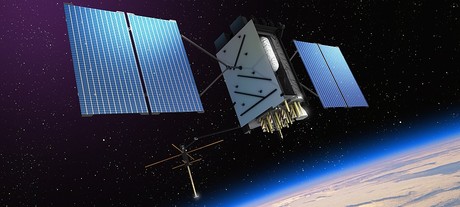
Budget 2018: Improved GPS, satellite imagery

The federal government announced in last night’s Budget that it is investing $260 million to develop GPS and satellite technology.
The funding includes $160.9 million to deliver the Satellite-Based Augmentation System (SBAS) to improve the reliability and the accuracy of positioning data from five metres to 10 centimetres across Australia’s landmass and maritime zone.
$64 million will be invested in the National Positioning Infrastructure Capability, to complement SBAS and improve GPS accuracy to 3 cm in areas with mobile coverage.
Digital Earth Australia will receive $36.9 million, to give provide greater access to standardised satellite data that identifies physical changes to the environment.
Examples of expected benefits from these technologies include:
- virtual fencing for farms and better management of livestock over vast distances;
- enabling aircraft to land on smaller runways in regional areas and navigate difficult terrain such as canyons;
- reducing the impact of weather on flight cancellations and diversions, and improving the safety of landings;
- better control of mine infrastructure and improved safety, and more precise data for environmental rehabilitation;
- better understanding of environmental changes such as coastal erosion, crop growth and water quality.
“We rely on satellite and GPS technology for just about every aspect of our lives — from Google Maps on our individual phones, through to air traffic control at the busiest airports,” said Minister for Resources and Northern Australia Matt Canavan.
“More accurate GPS will improve productivity by allowing new technology to be created and used across the economy. Growing Australia’s digital economy will also benefit developed sectors such as mining, transport, construction, aviation and agriculture.”
Please follow us and share on Twitter and Facebook. You can also subscribe for FREE to our weekly newsletter and bimonthly magazine.
ARCIA update: engaging with industry in 2026
ARCIA is encouraging the radio and critical communications industries to participate in a...
RFUANZ report: welcome to 2026
There has been plenty going on with RFUANZ recently — here are a few of the key things that...
2025–26 Thought Leaders: Tim Karamitos
Tim Karamitos from Ericsson discusses the connectivity requirements of emergency services and...


